Cookies help us deliver our services. By using our services, you agree to our use of cookies. Learn more.
  • Log In
  • Register
CEEOL Logo
Advanced Search
  • Home
  • SUBJECT AREAS
  • PUBLISHERS
  • JOURNALS
  • eBooks
  • GREY LITERATURE
  • CEEOL-DIGITS
  • INDIVIDUAL ACCOUNT
  • Help
  • Contact
  • for LIBRARIANS
  • for PUBLISHERS

Content Type

Subjects

Languages

Legend

  • Journal
  • Article
  • Book
  • Chapter
  • Open Access
  • Geography, Regional studies
  • Geomatics

We kindly inform you that, as long as the subject affiliation of our 300.000+ articles is in progress, you might get unsufficient or no results on your third level or second level search. In this case, please broaden your search criteria.

Result 321-340 of 481
  • Prev
  • 1
  • 2
  • 3
  • ...
  • 16
  • 17
  • 18
  • ...
  • 23
  • 24
  • 25
  • Next
Modern Methods for Spatial Urban Planning

Modern Methods for Spatial Urban Planning

Author(s): Ana Cornelia Badea,Gheorghe Badea / Language(s): English Issue: 27/2019

Urban planning involves functions, scales, sectors, and stages and the main functions of urban planning can generally be classified into general administration, development control, plan making, and strategic planning. Currently, the focus is on creating smart cities with increased functionality and on sustainable regional urban systems, with a positive economic impact. Both decision makers involved in urban planning, as well as local and municipal councils, can use the application of modern 3D planning methods to obtain the overall image of urban development. Traditionally, the information management process for local urban projects has been unidirectional and manual. GIS provides planners, surveyors, and engineers with the tools they need to design and map the area of interest. We highlight the workflow applied in an urban area through using, defining or creating of 3D Basemap, Zoning Types, Overlay Types, Building Types, Space Use Types, Project Status Types, according with the general urban plan, focused on the GIS instruments.

More...
Virtualising Space – New Directions for Applications of Agent-Based Modelling in Spatial Economics

Virtualising Space – New Directions for Applications of Agent-Based Modelling in Spatial Economics

Author(s): Marcin Woźniak / Language(s): English Issue: 347/2020

Due to enormous technological progress, socio‑economic science has gained new possibilities of investigating complex and not well‑known socio‑economic phenomena. One of the recent promising research approaches is agent‑based modelling (ABM) with connection to geographical (GIS) data. ABM is a bottom‑up research method concerning individuals that live and interact in the artificial environment. In this type of simulation, evolution of the whole system and macro‑level patterns results from individual behaviour of autonomous entities. Combining ABM with GIS data moves the simulation into the real geographical space. Applying this approach provides powerful possibilities of more realistic socio‑economic simulations concerning urban and spatial economics, sociology and psychology. Geosimulation also helps to answer questions about dependencies between geographical space and economic performances of modern cities. In this paper, a closer look at this topic is presented. We deal with the problem of implementation of GIS data into agent‑based modelling software. In the first step of our research procedure, we compare ABM programming platforms, then we chose three of them which provide GIS data support. In the second step, we implement OpenStreetMap GIS data for one of the districts of Poznań into these programming platforms. Finally, we compare the performance of ABM platforms regarding three major criteria: difficulty of programming, GIS data compatibility and available technical support. Our research is the first step in developing a complex socio‑economic urban system under the ABM paradigm.

More...
Using GIS for Landslides Graphical Representation. Case Study in Cornăţel (Hârtibaciului Plateau)

Using GIS for Landslides Graphical Representation. Case Study in Cornăţel (Hârtibaciului Plateau)

Author(s): Gheorghe Roșian,Csaba Horváth / Language(s): English Issue: 1/2020

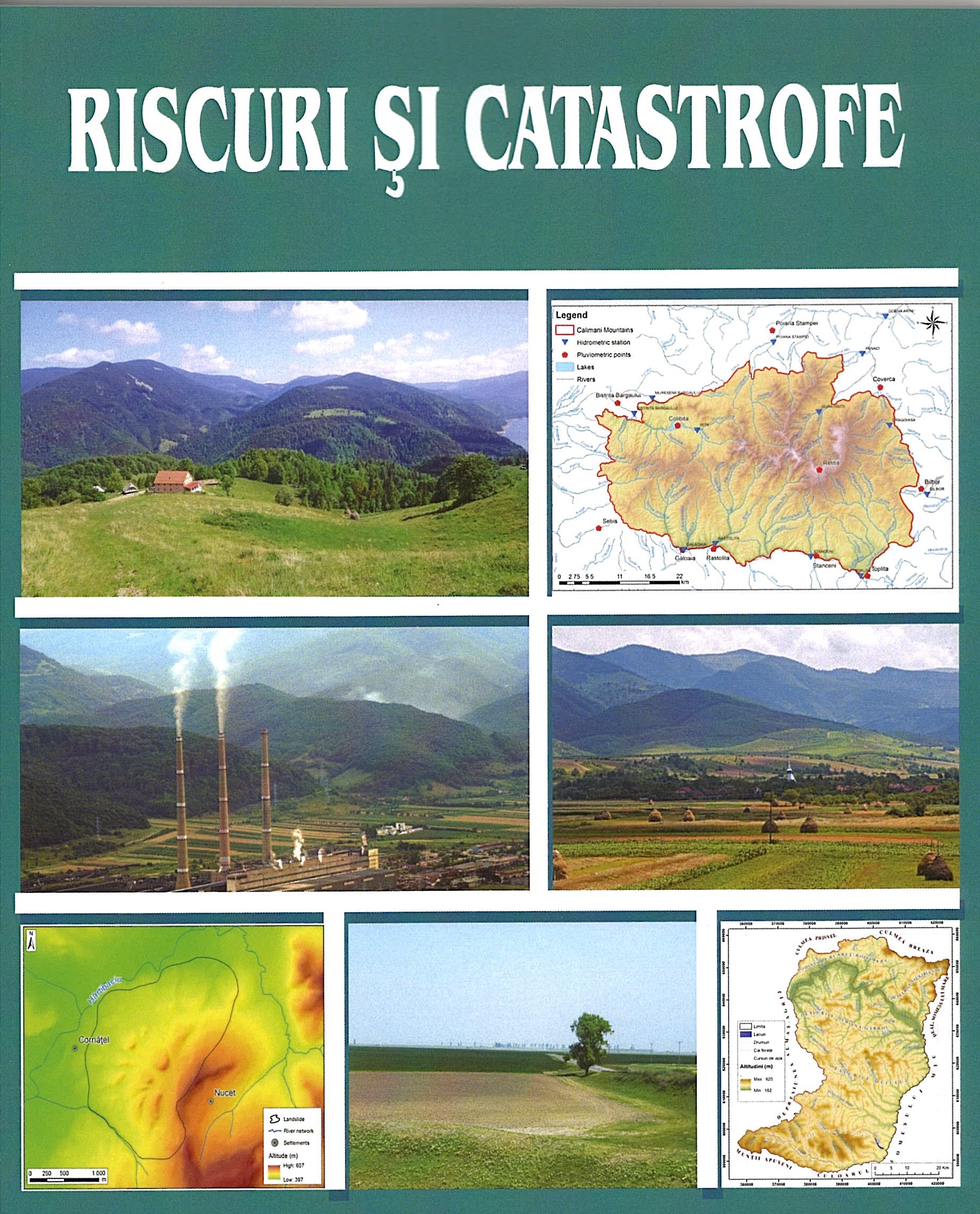
This paper it’s part of the present concern regarding the graphical representation of landslides. A very particular category of landslides is the glimee type. Of the territories in which they are frequently encountered, the Transylvanian Depression must be noted. Despite that these landslides are considered stable, since they occurred thousands of years ago, they were affected in time by various geomorphological processes. These include the recent (shallow) landslides, runoff on the slope, etc. For a correct graphical representation of both the old landslide and the current processes, which by their manifestation contribute to the genesis of new relief microforms, a GIS methodology was used. By using it, one can obtain both a graphical representation of various generations of landforms and can also make calculations allowing them to find out exactly their surface. This aspect has obvious practical connotations. As case study we used the landslide of Cornăţel, located in the south-western part of Hârtibaciului Plateau, an old glimee type landslide.

More...
Wskaźnik przemian przepuszczalności gruntów słabonośnych

Wskaźnik przemian przepuszczalności gruntów słabonośnych

Author(s): Marzena Jaromińska / Language(s): Polish Issue: 2/2015

This paper presents the results of analyses of the tendencies in the changes of organic soil permeability under load. Ten samples of peats and gyttjas from the Warmia and Mazury Province were analyzed. The research methodology was described and the e – log k relationship at five load degrees was analyzed. The results of multi-year research on organic soils conducted at the laboratory of the Chair of Geotechnics and Road Engineering at the Faculty of Geodesy, Geospatial and Civil Engineering of UWM (Olsztyn) were used for the analyses. A large spread in the permeability change index value, depending on the soil type and the load degree, was found as a result of the performed analysis. Such results suggest, apart from measuring errors, a very high effect of the microstructure of organic soils on the filtration coefficient value and thus also on the tendencies in the changes of this parameter in the consolidation process. The precise identification of the dependence of the filtration coefficient k on the void ratio e and knowledge of the tendencies in soil permeability changes with changes in the void ratio or porosity will allow the value of the filtration coefficient k at different settlement values to be predicted. It will also enable the determination of permeability based on the initial soil parameters.

More...
Monitorowanie przemieszczeń wybranego budynku posadowionego na podłożu ekspansywnym

Monitorowanie przemieszczeń wybranego budynku posadowionego na podłożu ekspansywnym

Author(s): Aleksandra Gorączko,Maria Gadomska,Maciej Kumor / Language(s): Polish Issue: 2/2014

The paper presents the methodology and results of the monitoring of the building, which failed geotechnical reasons. The building is located in Bydgoszcz, and founded into the clays of high expansiveness. Faults in the design of structure and during exploitation led to the activation of the processes of swelling and shrinkage, and consequently the failure state of the structure. After the strengthening of the foundations and repair construction, geotechnical monitoring was conducted, covering, inter alia, systematic measurements of vertical displacements. Monitoring results showed a very slow process of stabilizing movements of the building. This indicates the legitimacy of observation even for several years after the repair of this type of buildings.

More...
Weryfikacja parametrów podłoża gruntowego z wykorzystaniem analizy wstecznej na przykładzie wiaduktu drogowego

Weryfikacja parametrów podłoża gruntowego z wykorzystaniem analizy wstecznej na przykładzie wiaduktu drogowego

Author(s): Krzysztof Nepelski / Language(s): Polish Issue: 2/2014

The paper presents the analysis of foundation of the road bridge. The numerical calculation of the bridge abutment was made in FEM Software with subsoil modelled as solid defined by Cam Clay model. Number of calculations was made by using variable parameters of soil. Results were compared with geodetic measurements. Soil properties designated by lab test and geological boreholes, were verified with computer back analysis results.

More...
Analiza numeryczna mostu gruntowo-stalowego

Analiza numeryczna mostu gruntowo-stalowego

Author(s): Damian Bęben,Michał Wrzeciono / Language(s): Polish Issue: 2/2014

The paper presents a numerical analysis of the soil-steel bridge in the scope of static loads. The Abaqus program based on the FEM was used to calculations. Maximum displacements were obtained in the shell crown, and the largest stresses in the haunches. Calculation results were compared with the experimental ones and previous calculations obtained from the Robot Millenium program. The shapes of calculated displacements and stresses are similar to those obtained with the experiment, but the absolute values were generally higher than measured ones. Using both calculation programs, the relative reductions of displacement were in the range of 15–39%, and 17–44% for stresses in favour of the Abaqus program. Developed calculation model of the soil-steel bridge in the Abaqus program allows to obtain reasonable values of internal forces in the shell structure.

More...
Analiza numeryczna i doświadczalna propagacji pola elektromagnetycznego w badaniach metodą georadarową

Analiza numeryczna i doświadczalna propagacji pola elektromagnetycznego w badaniach metodą georadarową

Author(s): Magdalena Rucka,Jacek Lachowicz / Language(s): Polish Issue: 2/2014

This paper presents experimental tests by using the GPR method and numerical analysis of electromagnetic field propagation. The object of the experimental research was a ground floor structure. An antenna of frequency of emitted waves equal to 2 GHz was used for measurements. The paper also describes the numerical modelling of electromagnetic field with the use of the finite difference time domain method. Results of propagation of electromagnetic waves in a one-dimensional reinforced concrete specimen were presented.

More...
Ocena efektywności preparatów na bazie kwasu
ortokrzemowego do wzmacniania zabytkowych
zapraw sztukatorskich typu lubelskiego

Ocena efektywności preparatów na bazie kwasu ortokrzemowego do wzmacniania zabytkowych zapraw sztukatorskich typu lubelskiego

Author(s): Danuta Barnat-Hunek,Beata Klimek / Language(s): Polish Issue: 4/2013

At the beginning of XVII-th Century in Little Poland region, flat, geometric decorations were common. Their came from North Germany and appeared in individual types, characteristic for particular regions. Typical variants of decorations were described by J. Szablowski with underlined net (typical for Lublin region), ferrule and geometrical decorations (typical for Cracow region). Cracovian-type decoration resembled West-European decorations and Lublin-Calisia-type were made by local bricklayers, which is hard to be proven, because of the foreign prototypes visible in many Lublin decorations. Article presents valuation of the silicon based preparations application possibility for strengthening Lublin-type mouldings. Valuated preparations differ in compounds. They are applied for conservatory works to strengthen such materials like calcium plasters and mouldings.

More...
Dobór zestawu maszyn do robót ziemnych
w aspekcie minimalizacji emisyjności CO2

Dobór zestawu maszyn do robót ziemnych w aspekcie minimalizacji emisyjności CO2

Author(s): Magdalena Rogalska / Language(s): Polish Issue: 4/2013

The aim of the calculation is to allow the selection of a set of earthmoving machinery in terms of minimizing the emission of CO2. The capacity of excavators and CO2 emission of set of machines was predicted. The forecasting methods: multiple regression and neural networks were used. The analysis of autocorrelation and partial autocorrelation residuals and sensitivity analysis were performed. The MAPE errors of forecasts were calculated. The calculation example in terms of selection of machines emission of carbon dioxide on the basis of forecasting models was performed.

More...
Wykorzystanie gruntów rodzimych do budowy dróg
lokalnych na terenach wiejskich

Wykorzystanie gruntów rodzimych do budowy dróg lokalnych na terenach wiejskich

Author(s): Michał Ćwiąkała,Andrzej Greinert,Joanna Korzeniowska,Paweł Tarasewicz / Language(s): Polish Issue: 3/2013

Virgin soils as a result of geotechnical processes are element of road’s solid bottom. The bottom ought to have enough capacity and durability which is provided by proper virgin sub-grade’s enhancement. The sub-grade is road’s base course right bottom. It is possible to improve virgin soil’s parameters by road’s hydraulic binding agent. The agent is a mineral frame’s micro-particle extender or enhancement. The researches were focused to define main soil-cement compound’s mechanical parameter called CBR. Compounds consisted of rural virgin soils (five grain-size types) and two hydraulic agent types (endurance rates 3 MPa and 9 MPa). Hydraulic agent’s main component was activated fly ash and white cement (CEM I 42,5 MPa). The ash is from Pątnów Power Plant and is a result of brown coal burning. The researches answered that it is possible to exploit virgin soils in rural service road’s construction thanks to innovative road cements with binding qualities.

More...
Use of Digital Land Models in Automated Execution of Embankment Works

Use of Digital Land Models in Automated Execution of Embankment Works

Author(s): Ioan Ienciu,Robert Drașovean / Language(s): English Issue: 28/2020

The following project tackles modern solutions in the execution of embankments for railroads making use of Digital Terrain models with wich machines can be guided using GPS positioning such as Autograders for leveling platforms according to the designed heights and platform slopes or Excavators in digging twinning steps, slopes covered with rip-rap and so on. The DTM’s are developed individually for each platform using ArcGIS and according to the designed heighs and offsets specified in the project.

More...
Topographic Works Necessary to Prevent Landslide on Forest Roads

Topographic Works Necessary to Prevent Landslide on Forest Roads

Author(s): Ioan Ienciu,Robert Drașovean / Language(s): English Issue: 28/2020

The forest road is a permanent communication route which includes all the works related to the optimal development of the traffic: bridges, signs, consolidation works or any other constructions or arrangements included in the forest road project. Considering the location of these communication routes, as well as the natural and anthropic factors that influence their lifespan, through this project we aimed to present the usefulness of topographic works for raising and tracking the action of natural phenomena that influence the infrastructure of a exploitation road. These works have the role of providing a more detailed and precise digital terrain model of the situation in order to develop constructive technical solutions to counteract the destructive activity of these phenomena.

More...
Study Regarding the Degree of Performance the Cadastre Works in Crăciunelu de Jos Territorial Administrative Unit

Study Regarding the Degree of Performance the Cadastre Works in Crăciunelu de Jos Territorial Administrative Unit

Author(s): Luciana Oprea,Ioan Voina,Daniel Cioara / Language(s): English Issue: 28/2020

In the present, our country is trying to carry out the works for the introduction of the general cadastre in as many administrative and territorial units as possible, through the “National Cadastre and Land Registry 2015-2023”. On this context, it will be strengthened to realize the cadastre of the land fund in order to establish equitable taxes and duties throughout the national territory. At the same time, in parallel, sporadic cadastre works are carried out to serve the urgent needs of citizens. In this context, this paper presents the case study regarding the introduction of the cadastre within the Crăciunelu de Jos Territorial Administrative Unit.

More...
Improving Semantic Modeling with the Help of Augmented Reality

Improving Semantic Modeling with the Help of Augmented Reality

Author(s): Daniela-Paula Safta,Iohan NEUNER / Language(s): English Issue: 28/2020

A semantic modeling makes it possible to add, in addition to geometric data, as much information about architectural elements.In order to create a semantic modeling that has a unitary structure for all geometrically modeled buildings, regardless of who makes this model, it was proposed in this article to create an application based on augmented reality to help semantic modeling of historical buildings on the architectural side. This application will be the basis of semantic annotations in the field of architecture.When several important buildings have been modeled using the same unitary structure, they can be represented in a semantic Web.

More...
The Use of Several Types of Geometric Modeling to Create the Model of  a Historical Building

The Use of Several Types of Geometric Modeling to Create the Model of a Historical Building

Author(s): Daniela-Paula Safta,Iohan NEUNER / Language(s): English Issue: 28/2020

A geometric model is a mathematical representation of the geometry of an object or a building as a whole, using geometric shapes, which are described by surfaces, which in turn are described by curves and so on. Data such as the geometry, the topology and other specific data have to be represented by the model.Many computer-aided design systems use parametric polynomial representation for free-form curve and surface modeling.In this article we will present a brief description of the existing types of geometric modeling, as well as a comparison of them.

More...
Brief History of the Height Reference Systems Used along the Romanian Sector of the Danube River

Brief History of the Height Reference Systems Used along the Romanian Sector of the Danube River

Author(s): Elena-Andreea Savu / Language(s): English Issue: 28/2020

Both geodetic engineers and specialists in the fields such as Hydrology, Hydrotechnics or Geography have faced countless times the problem of using multiple height reference systems on the territory of our country. Over the years, several "zero" points or fundamental points have been used in Romania: "zero" Black Sea Sulina, "zero" Adriatic Sea or "zero" Baltic Sea (most often used). Regarding the Romanian sector of the Danube River, all bathymetric navigation maps use Sulina as a fundamental “zero” point. Unfortunately, the (absolute) heights of the gauges “zero” installed along the Danube River differ from each other depending on the reference surface from which these heights are measured. For this reason, the water level determinations cannot be performed in the same height reference system. In practice, the transformations between different vertical datums used along the river are still a real challenge. This paper supports those who want to understand the history of using the main height reference systems on the Romanian sector of the Danube River and, moreover, represents a review of the relationships between them. Although they were determined long ago, some of them have been transposed into the GIS format to facilitate the height transformations.

More...
Digitalization of the National Agency for Cadastre and Real Estate Advertising Services through 
E-Terra and E-Pay Applications in the Context of the COVID Pandemic 19

Digitalization of the National Agency for Cadastre and Real Estate Advertising Services through E-Terra and E-Pay Applications in the Context of the COVID Pandemic 19

Author(s): George Emanuel Voicu,Florina Voicu,Ioan Voina / Language(s): English Issue: 28/2020

The accelerated pace of technological changes, which have irreparably changed the communication area and the business area, is so advanced that we can already discuss a post-digital age. According to research conducted by International Data Corporation, $ 1.25 trillion was spent globally in 2019 for digital transformations, the number rapidly increasing to $ 1.97 trillion by 2022, when over 60% of global Gross Domestic Product it will be digitized, generating growth in every area where offerings, operations and relationships are digitally improved.

More...
Pomiary parametrów przepływów dwuwymiarowych
wokół modeli o przekrojach czworokątnych ustawionych
na podłożu

Pomiary parametrów przepływów dwuwymiarowych wokół modeli o przekrojach czworokątnych ustawionych na podłożu

Author(s): Ewa Błazik-Borowa,Jarosław Bęc,Tomasz Nowicki,Tomasz Lipecki,Jacek Szulej / Language(s): Polish Issue: 2/2008

Measurements of 2-D flows around a square and a rectangle (ratio 2:1) in wind tunnel have been presented in this paper. The results of these measurements presented here are pressure and standard deviation distributions on the models’ walls, components of velocity vectors and statistical moments for fluctuations of velocity in the wind tunnel measuring space. The values of parameters have been presented in graphs and subsequently used in a comparative analysis of the flows around both models.

More...
Pomiary wilgotności murów z kazimierskiej opoki
wapnistej przy zastosowaniu metody TDR

Pomiary wilgotności murów z kazimierskiej opoki wapnistej przy zastosowaniu metody TDR

Author(s): Zbigniew Suchorab,Danuta Barnat-Hunek,Henryk Sobczuk / Language(s): Polish Issue: 1/2008

The article presents monitoring measurements of the physical parameters and mineralogical-petrographical composition analysis of the chalk rock from the Kazimierz Dolny region. The experiments involve the reflectometric techniques TDR (Time Domain Reflectometry) as a perspective alternative in moisture determinations. The investigation domain was the stone from the Castle of Janowiec by the Vistula river, which walls indicate the progressive corrosion depending on external exposition and age. Other object of investigations was the stone from quarry in Kazimierz Dolny. Porosimetric examinations of the chalk rock from the southern and northern elevation of the castle indicate differences in structure changes of the stones. These differences influence different behaviour of the chalk rock during capillary rise of water and salt solutions. It is connected with the suitable matching of the conservation protection, wall protecting preparations which kind and application depend on porosimetric parameters of the material. The TDR method is applied as a good alternative of water transport measurement in porous building materials and other water parameters characterisig described material.

More...
Result 321-340 of 481
  • Prev
  • 1
  • 2
  • 3
  • ...
  • 16
  • 17
  • 18
  • ...
  • 23
  • 24
  • 25
  • Next

About

CEEOL is a leading provider of academic eJournals, eBooks and Grey Literature documents in Humanities and Social Sciences from and about Central, East and Southeast Europe. In the rapidly changing digital sphere CEEOL is a reliable source of adjusting expertise trusted by scholars, researchers, publishers, and librarians. CEEOL offers various services to subscribing institutions and their patrons to make access to its content as easy as possible. CEEOL supports publishers to reach new audiences and disseminate the scientific achievements to a broad readership worldwide. Un-affiliated scholars have the possibility to access the repository by creating their personal user account.

Contact Us

Central and Eastern European Online Library GmbH
Basaltstrasse 9
60487 Frankfurt am Main
Germany
Amtsgericht Frankfurt am Main HRB 102056
VAT number: DE300273105
Phone: +49 (0)69-20026820
Email: info@ceeol.com

Connect with CEEOL

  • Join our Facebook page
  • Follow us on Twitter
CEEOL Logo Footer
2025 © CEEOL. ALL Rights Reserved. Privacy Policy | Terms & Conditions of use | Accessibility
ver2.0.428
Toggle Accessibility Mode

Login CEEOL

{{forgottenPasswordMessage.Message}}

Enter your Username (Email) below.

Institutional Login